 |
|
|
|
Ogden – Around Thornton Moor Reservoir
(Circular)
Distance: 5.25 miles
Time: Approx 2 hours
Start: At either the Ogden Water car park (or on street around Causeway Foot)
Head up the A629 from Causeway Foot towards Denholme for approx 1 mile, passing
Denholme
Velvets, until you reach a side street on the left, Black Edge Lane (which
is also part of the Bronte
Way but isn’t signposted at this end). This is the least attractive part
of the route but worth it.
Ascend Black Edge Lane, which opens up to fine views over moorland. This lane
is heavily rutted in
places and can hold large pools of water after heavy rain.
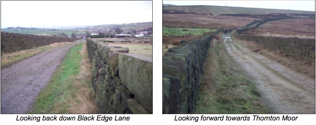
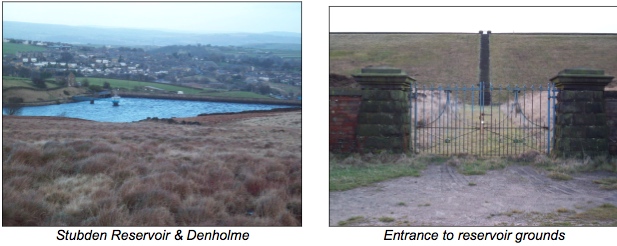
Continue on the lane, which becomes Thornton Moor Road. Eventually
Stubden Reservoir will come
into view on the right, with Denholme village beyond, further on passing (at
2 miles) an entrance
to the Thornton Moor reservoir grounds on the left, the
reservoir edge now clearly seen above you.
Soon the estate buildings come into view just after an outflow
on the left. Two pools and an air shaft
can be seen on the right.
Continue passed the buildings, on to a tarmac road through two sets of gates.
You are now above
Oxenhope and can look down on Leeming Reservoir with a signpost showing the
Bronte Way route
both ways. Follow the path around to the left passing the far end of the Thornton
Moor Reservoir until
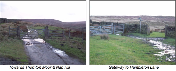
you reach a wooden gate, the entrance to Thornton Moor, with Nab Hill in the
distance.
Continue onto the path following it round to the left to meet a split in the
route at 3 miles. Right takes
you downhill on a lane below Nab Hill but we want the left hand route through
the metal gate onto a
walled greenway, Hambleton Lane (although not signposted as such).
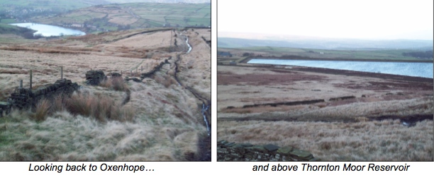
Go up the ‘lane’ sometimes over exposed stone until
you reach the top of the first ascent. Look back
down towards Oxenhope to the right and Thornton Moor Reservoir on the left.
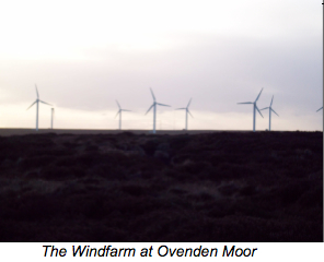
Once onto the moor top follow the well defined route, heading
due south. The Emley Moor TV mast
can be seen on the horizon. Keep this directly in front of you for the walk
across the moor. Eventually
the Ovenden Moor windfarm is seen across the clough on the right.
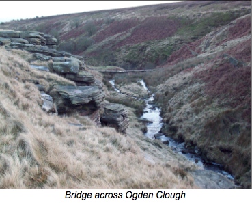
The route is straightforward, passing a small a couple of cairns
in the centre of your route, and a
couple of examples of minor quarrying on the left. Soon you reach Ogden Clough,
a meeting of
various routes (at 4 miles) with a seat provided on top of the rocks. Right
here would take you down
to a bridge across Ogden Kirk and heading towards The Withens. Left would take
you up to Foreside Lane
eventually emerging at Denholme Velvets. We want to continue
straight on.
Eventually the path drops down to a metal gate, go through it.
You have options here, either continue
down the walled ‘lane’ (Back
Lane, a route of an old Roman pathway) which takes you back down to
Causeway
Foot or climb up to the right to continue your walk back on moorland then down
across a
grassy trail leading back to Ogden Water car park, passing examples
of dry stone walling when almost
there.