 |
|
|
|
Distance: 6 miles
Time: Approx
3 hours
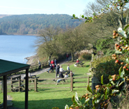
Start: Ogden
Water car park
Depending on the weather it can be muddy in places across Nab Hill.
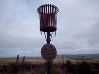
Start from the car park and head over the Promenade to take the rough road (Withens New Road) up past the golf course, skirting the Ogden Water plantation, eventually leaving it behind to have a grand view of the wind farm on the right and across to Halifax on the left. Go through the gate at The Withens and out onto Cold Edge Road. However, as you pass through the yard notice the beacon and deteriorating Millennium sign designating this as the highest pub in West Yorkshire (sadly no longer a hostelry).
Also notice the gravestone across the car park where two dogs are buried with the sad yet humorous inscription 'Here lie the remains of Wallet and Dart Who in their last race made a capital start. But their owners lamented, they never got through it, Alas they were drowned in Thornton Conduit...' These dogs were drowned on March 31st 1891'
From here you can look across to Midgley Moor, behind which Hebden Bridge and Heptonstall are hidden. Stoodley Pike will also be in view, dominating the landscape from its position above the Calder Valley.
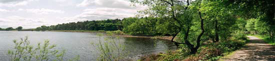
From The Withens turn right towards the wind farm for a stretch of flat road walking past the Halifax Sailing Club at Warley Moor Reservoir (also known as Fly Flats Reservoir). Hopefully there will be sailing on the day of your walk but on the numerous occasions I’ve been I’ve never witnessed it.
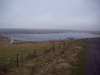
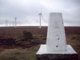
This road would eventually take you to Oxenhope. The section next to the reservoir is not well maintained and the area is sadly blighted by fly-tipping. On the right are a number of abandoned quarries (Fly Delph) and for the more adventurous is worth a detour to get to the OS triangulation point with a sentimental plaque to someone’s deceased walking friend, and an excellent view of the northern edge of the wind farm as a bonus.
Having passed the reservoir the road starts going downhill. Here look out for a signpost on the right directing you over a stile and up onto Nab Hill. From here and across Nab Hill the surface can be muddy after bad weather, so take care.
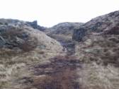
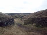
The path takes you into more old delphs before eventually bringing you out onto the top and a series of man made structures (the building of which can be seen on the Ogden Water website photo gallery section). If you haven’t already seen them I won’t spoil your surprise by including pictures.
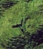
Among the several structures homage is paid to the nearby wind farm and to the author Douglas Adams. I’ll leave you to work them out from the ground but a clearer view is shown at the end of this walk description. From the ‘sculptures’ look back to the wind farm and you should be able to see the OS triangulation point mentioned earlier.
Even on a good day you can also certainly understand why a wind farm was placed up there and I’ve been thankful for the shelter of one of the cairns. But even so this is a great spot to take in refreshment with the views across the Worth Valley. Oxenhope (with Leeming Reservoir) in the near distance, then Haworth with Oakworth just beyond and Keighley further down the valley. Directly below is the catch-water channel for Thornton Moor Reservoir.
Back on the track continue along the top of Nab Hill, skirting Great Clough and Little Clough (known in the past as Great Arse and Little Arse!, apparently from the resemblance to that part of the anatomy as seen from below the hill-side) eventually reaching a gate, bringing us out onto a rough way, Hambleton Lane (which was pronounced Hameldon by older generations up to the 1970s, hamel dun meaning “rough hill” in Old English)
Turn right here as we start the return back towards Ogden.
Once onto the moor top follow the well defined route, heading due south. The Emley Moor TV mast can be seen on the horizon. Keep this directly in front of you for the walk across the moor. Eventually the Ovenden Moor windfarm is seen across the clough on the right
The route is straightforward, passing a pair of small cairns in the centre of your route, and a couple of examples of minor quarrying on the left. Soon you reach Ogden Clough, a meeting of various routes with a seat provided on top of the rocks. Right here would take you down to a bridge across Ogden Kirk and back towards The Withens if you wanted to take the rough road back to Ogden Water
Eventually the path drops down to a metal gate, go through it and climb up to the right to continue your walk back on moorland then down across a grassy trail leading back to Ogden Water car park, passing examples of dry stone walling when almost there.
Did you find the answer to the ultimate question of Life, the Universe and Everything ?
And the wind turbine?